Visited Kite Hill
This is the second of two Mount Washington area parks I visited last week! I mentioned this hill in an earlier blog post where I remarked that the road on the hilltop - Avenue 37 in Mount Washington - had been blocked by a gate. In fact, this is wrong: whatever happened last year, the gate is no longer up and it's possible to drive on the road.
I visited this place partially because I was very curious what a place "known for carjackings" actually looks like. It turns out that it looks beautiful and nice, and that - like pretty much every hilltop in the area except for Elephant Hill - there's almost no sign that anyone might ever do anything disruptive or untoward here. I'm not finding trash lying around on the trails or anything. I certainly believe that bad things happened here, but it's not going to make hiking here during the daytime any worse. If you're interested, you should go.
Kite Hill consists of a public road going along a hilltop, with two very short trails going east and west off of that road. Each trail is perhaps a fifteen minute walk, depending on your fitness and how fast you want to go. I went very slowly because I was taking pictures of everything, but Strava assures me that my moving time for both was still just around half an hour.
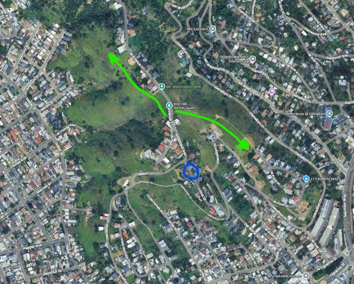
I parked on the south side, facing downhill on Lotus Street, where the blue circle is. The two trails follow the green arrows. Neither appears on Google Maps, but both appear on Open Street Map, so they'll turn up on Strava. The west/north trail heads out behind the houses on Avenue 37, stays relatively level for most of its length, and eventually disappears in the long grass. The trail on the east side is much wider and clearer. It goes steeply downhill and then flat along a ridge until it connects with West Point Drive. I found this eastern route very slippery and steep. I had quite a lot of trouble with it because my shoes are, perhaps, half a size too big.
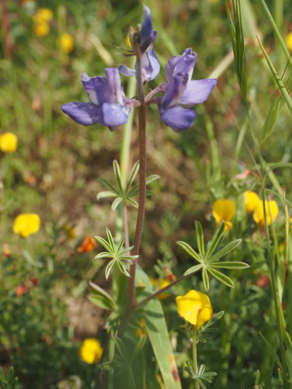
I saw a ton of wildflowers on this hilltop that I hadn't seen anywhere else in NELA hilltop parks before. In particular, I saw a lupine that I wasn't familiar with, and a little yellow wildflower I am still not entirely sure I've been able to identify. It felt very cool to still be discovering new wildflowers after the last two weeks of heavy wildflower-hunting!
I also saw a shit ton of grasshoppers, most of which were too fast and small for me to get pictures of. There were also a bunch of flattened patches of grass along the side of the trail, which indicated that there are much larger animals nearby that I also failed to photograph - coyotes or mule deer, maybe?
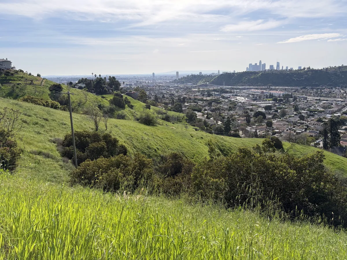
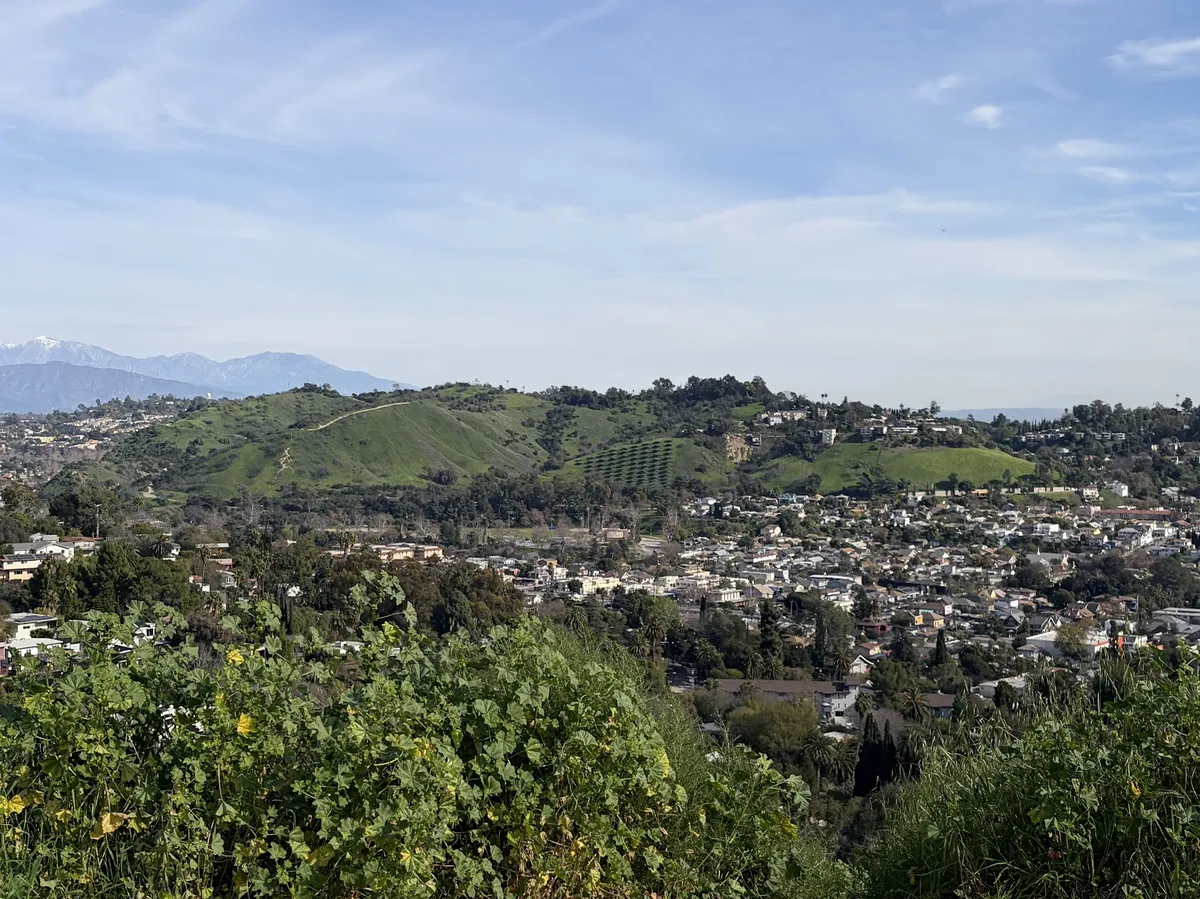
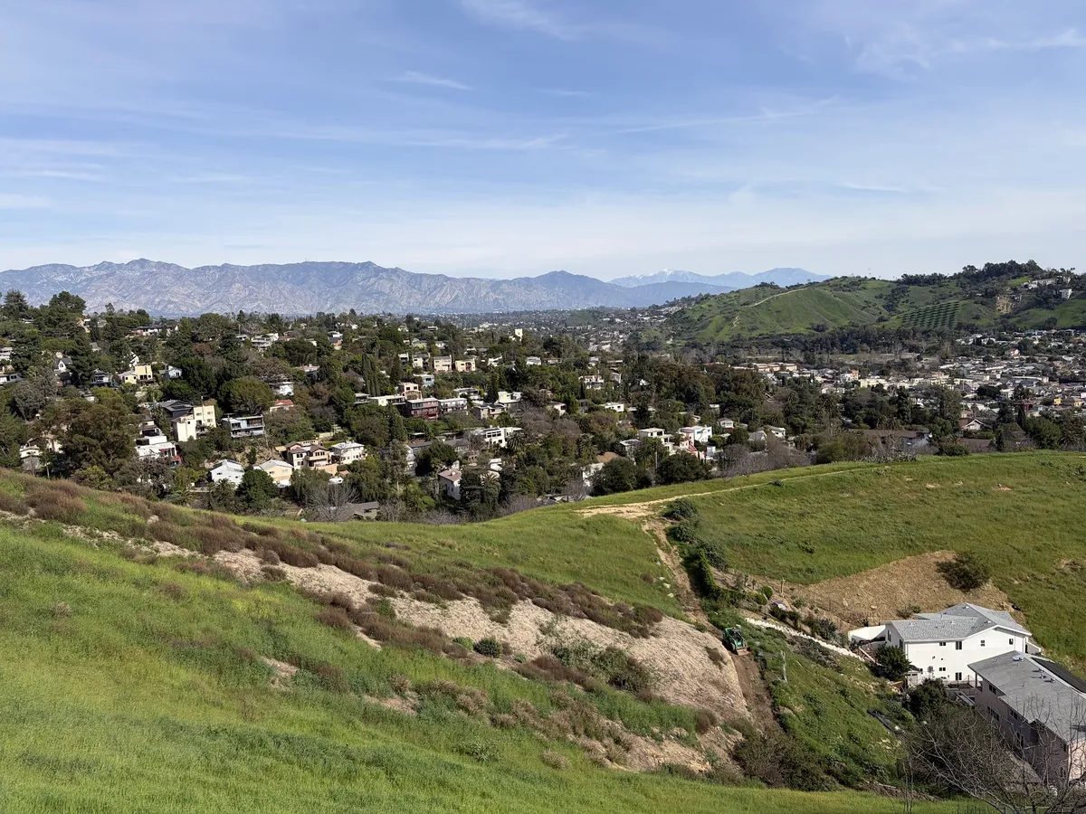
The road goes along the top of the ridge, so your views to the east will be the San Gabriels and the rest of the NELA parks, and your views to the west will be downtown, the Dodger Stadium area, Frogtown, and Griffith.
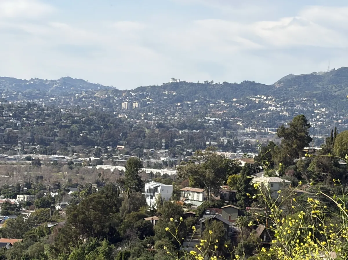
In fact, it seems that you can photograph Griffith Observatory from this hilltop, very very small in the center of this shot:
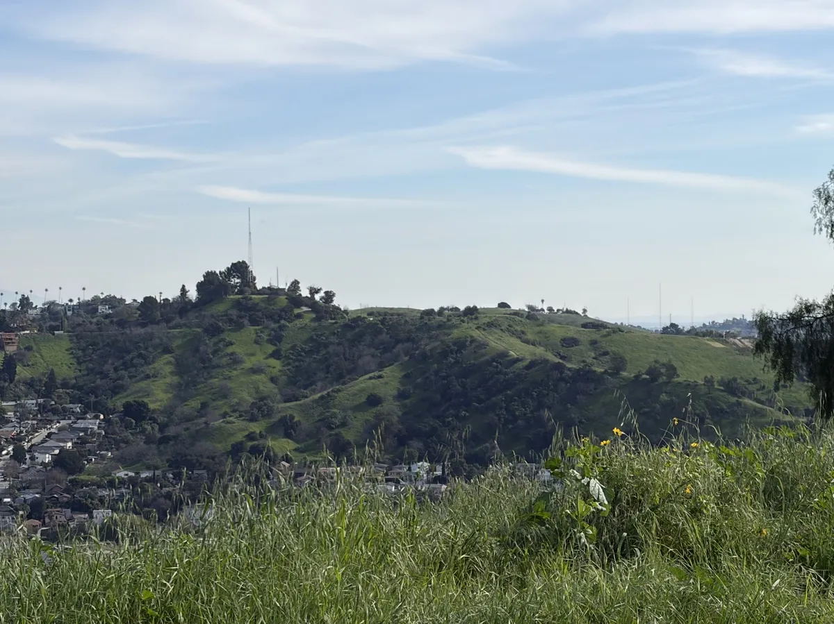
And stitching together all these views of the other parks FROM the other parks is a lot of fun. Here's Flat Top and its radio tower again:
I strongly recommend this spot! It's a great combination of all the different things that make these parks and parklike spaces interesting to me. For one, it doesn't seem to be "a real park." Zooming in on Google just gets you all the crazy individual lot numbers for the undeveloped lots going up and down the hillsides. Secondly, the hikes are quite fun for how short they are - lots of weird little plants, and a genuinely taxing climb on the east side of the hill.
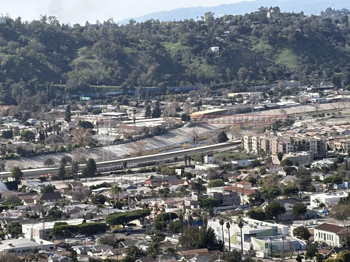
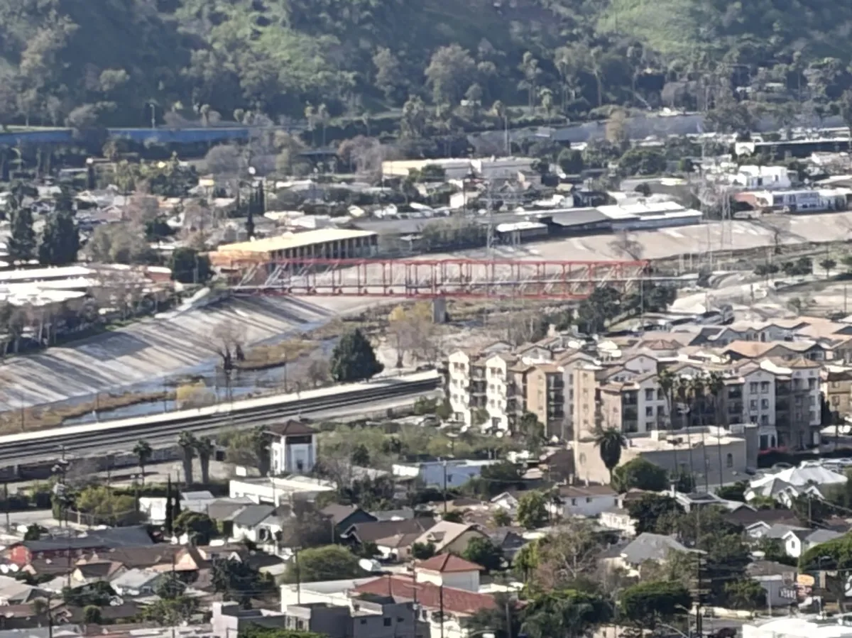
And the views are nuts! I could see all sorts of places I'd personally been before. I've never paid attention to this hillside in the past, but it turns out it was looking down on me many times over the years while I biked through this area. Here's the LA river and the orange bridge connecting the bike path:
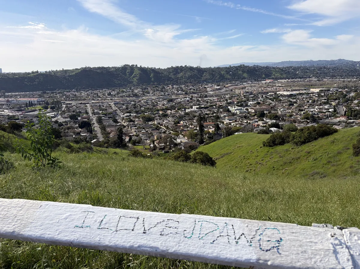
Here's Cypress Park and Frogtown, with some passionate graffiti:
Here's the back side of Ernest E Debs park, where I haven't yet been myself:
And here's the San Gabriels, with the burn scar?? still visible as the lighter patch of mountainside on the left side of this shot. If you zoom in enough - which I don't think you can do on this blog - you can even see the radio towers from Mount Wilson Observatory.
I love maps! And I love enjoying vistas of local geography. There's still a couple more hilltops for me to visit in this area, and I think I'm simply going to continue as long as I can - there are always weird things to see up here, and strange new angles to view the landscape from, and interesting local problems to read about once you've come back down the hillside. I recommend coming up here!