Pictures of Mandeville Canyon from Spring 2024
Mandeville Canyon Road is one of the spots in the city people have been talking about constantly over the last few days - It's the line where firefighters stopped the eastward progress of the fire on Friday. It's been very strange to hear people talking about this place because it's a tiny part of LA generally only interesting to its residents - and to cyclists.
Mandeville is a gigantic culdesac - five solid miles of uphill road, perfect for training your ability to climb on a bike. The road is pretty narrow, so cars tend to go slow, which makes it a safe place for cyclists. It's so popular with cyclists in the area that I've seen at minimum ten other people there every time I've biked there. Once I saw a group of over a hundred. The community is used to this attention from folks on bikes and is full of signs aimed visiting cyclists.
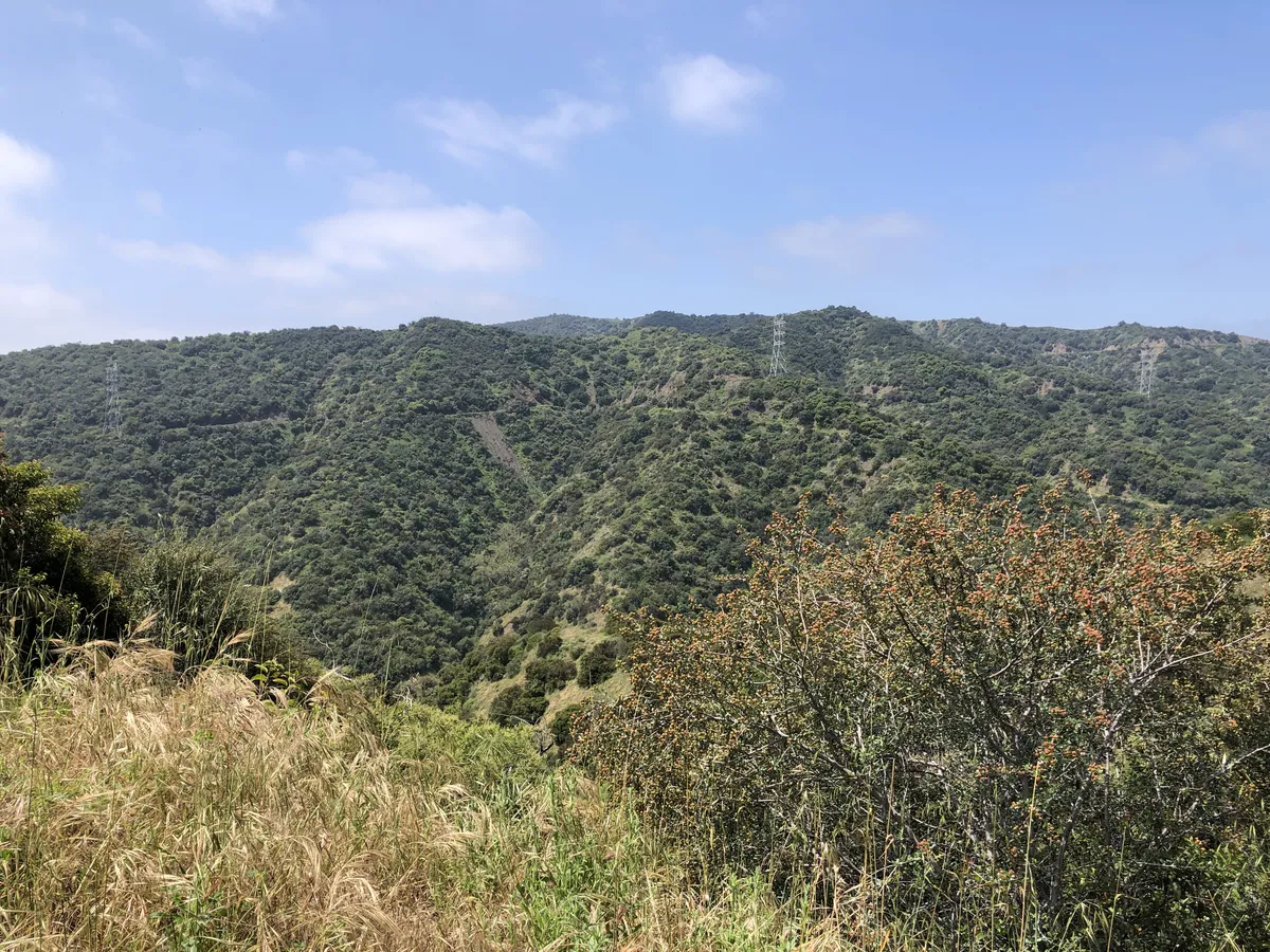
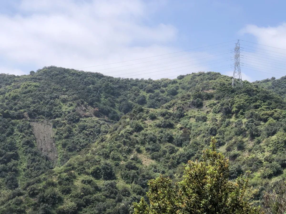
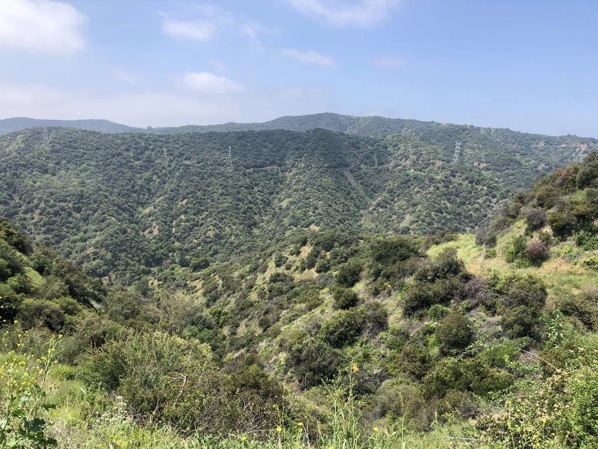
I am not a very good cyclist, really, and I didn't figure out how to find climbing fun until late last summer. I once biked up Mandeville to get to Hollyhock Fire Road so I could go up into the hills on the east side of the canyon, where I took these pictures. If you look closely, you can see the fire road on the upper part of the hill slope in each of these images. This is one of the spots where the fire was stopped before last Friday.
I've been looking at these images this past week and comparing them to the streaming YouTube footage from the various local news channels covering the fire. Most of the cameras were north of this spot. It's been very weird to see so many people filming a place I've spent so much time looking at on Google Earth, for my own ride planning reasons.
On Friday night the fire spilled over the fire road and started going downhill to the northeast toward the houses along the main road. At this time I started watching the fire maps very closely, because I was extremely pissed about the idea of ALL the good hikes and bike rides I wanted to do in the area getting burned the fuck up.
It felt extremely unfair to me that this one nice thing I'd planned for myself might get torched! But it didn't get torched. However, 24/7 news coverage of the fire became pretty breathless in a very surreal way.
This is a ridiculous comparison, but the best way I can describe this experience has been: imagine you made a reservation to eat at a restaurant for your birthday, and then a few days before your birthday, the restaurant is the site of a lurid poisoning tragedy the news cannot stop covering. Or something. It's just fucking weird to see people turning this neighborhood into the site of a great battle!
It pretty much was, though. Sometimes they had over ten helicopters at once circling over the fire and dropping water on it from the Encino reservoir to the north. My dad was watching a flight radar app and sending me updates on exactly which types of helicopters specifically were circling over this area. They had five of them refilling in the reservoir at once, at one point.
The clips kept rolling in. They were increasingly bizarre. On Saturday, ABC began doing constant reruns of a clip (which I have not been able to find online) of a helicopter dumping a pink haze of fire retardant on a reporter.
I have spent a lot of time looking at these mountains on Google Earth for my own entertainment, so it was very strange to see an entire news segment consisting of a guy scrolling around this area in Google Earth, exactly how I do, and motormouthing a stream of semi-meaningful information about it for the camera. (When you know about something, it makes it pretty dang obvious when someone is just filling air yammering about it rather than communicating anything useful.)
I'm so looking forward to the smoke going away so that I can go back to biking and perhaps even to biking in this area!! What a week. It feels like the first week is still going. I'm so eager for it to be over!!