Crossed West Coyote Hills in Fullerton
I wrote yesterday about my visit to Pirates Dinner Adventure in Buena Park on my birthday. Because that show is in Orange County, we traveled down very early in the day, on Metrolink, and spent the rest of our time doing a hike instead.
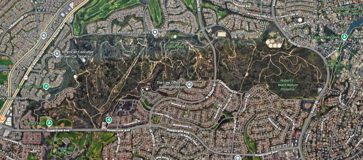
I'll admit, I'd assumed for years that there was not much hiking or biking to do in the main basin of Orange County. I guess I'd just not looked carefully enough at the map - there is a pretty obvious big chunk of wild land in Fullerton, just between the Buena Park and Fullerton Metrolink stations.
We entered the park from the east side, at the Robert E Ward nature preserve. The preserve lacks any parking facilities. Most of the people using it are, I assume, locals who bike or walk into the park. We just took rideshare to the church on Euclid St.
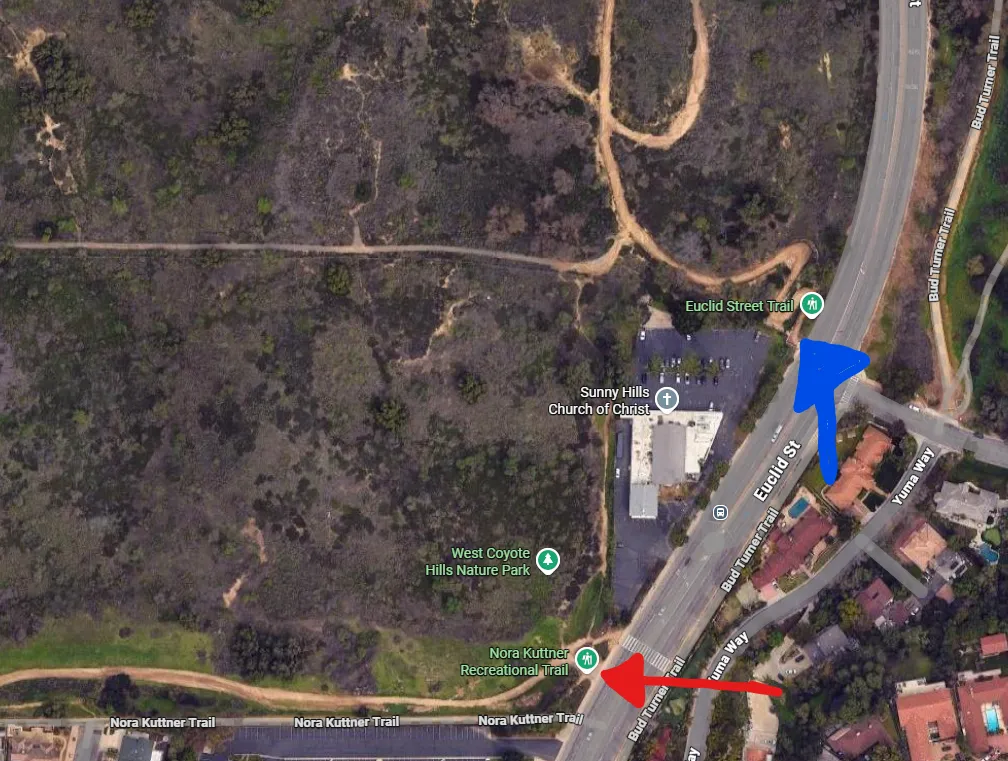
The red arrow in the above picture points toward the Nora Kuttner Recreational Trail. This is a separate walking trail that hugs the south border of the West Coyote Hills undeveloped region - which is both publicly and privately owned in different spots - for nearly its entire length. We hopped onto that trail halfway through our hike, which I'll describe later. It connects to the nature preserve in a pretty hard-to-miss spot, so you could enter the preserve this way if you wanted to.
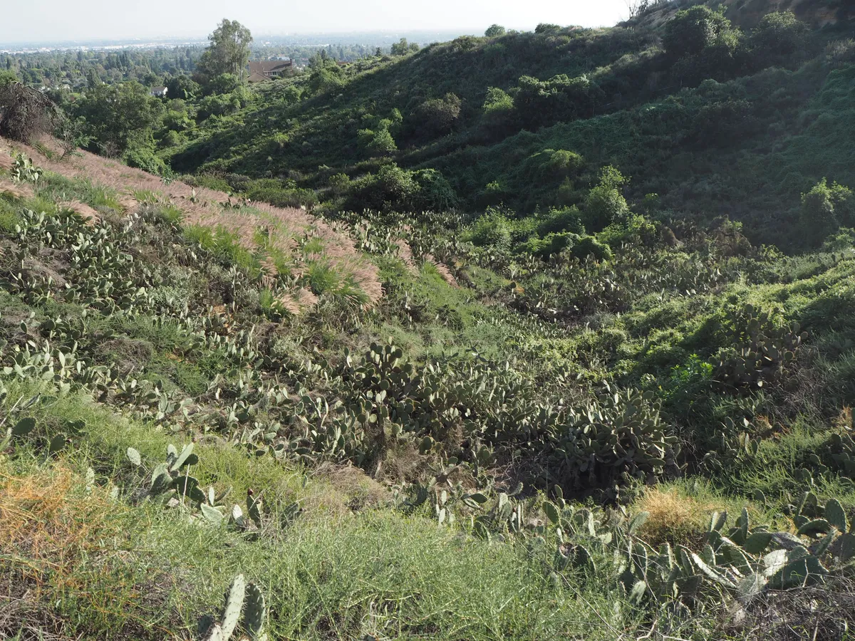
Cactus wrens are, I guess, the main native animal attraction of the park. Every canyon in the park is completely filled with cactus, and the birds build nests among them. I did not see any cactus wrens, but my vision is pretty bad, so I'm never good at noticing birds. I did see several California gnatcatchers, though! I guess that's cool!
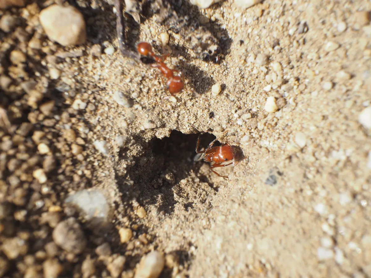
The main thing we did have fun photographing was the ants. I already posted some, but here's another ant pic:
The trails in this park are very, very wide and well maintained - it's a nice park! But there are tons of signs telling you to not ride horses or bike in the park. We saw them at every single intersection of every trail, including the intersections right in the middle of the park. Maybe they think that if you're on a horse or a bike, and you already rode past the signs at the gate asking you to keep away, you'd start feeling guilty eventually and turn around?
We saw maybe half a dozen people biking, though, including on e-mountain bikes. I think if their goal is habitat restoration, the park is right to ban bicycles. But they also built absolutely fucking gigantic trails everywhere that are more than big enough for bikes and horses. I suspect they built the trails so wide and sturdy because they're bringing trucks in here as part of the habitat restoration process? Or perhaps these roads were all originally here as utility access roads, and they kept the car-style grading? I'm not sure.
Anyway, every time a cyclist passed us, I thought about those long, wide, straight stroads you see all over SoCal with 40 MPH speed limit signs and traffic that routinely does 50 - 60. Sometimes the physical form of the trails you build can attract the traffic you don't want, I suspect.
At the back of the park, we also found signs telling us not to enter the non-park land to the northwest of the nature preserve.
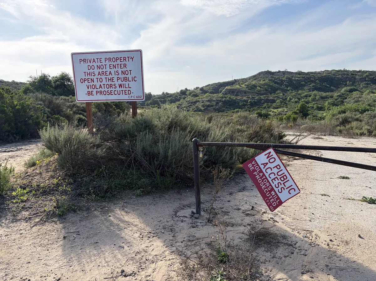
You could see deep bike tire ruts in the dirt there, though. It's pretty clear people are going into this land all the time. I guess this land is owned by a subsidiary of Chevron and Fullerton was trying to buy it last year, but we did see signs with Chevron's name on them elsewhere in this area, so I guess the sale is not yet complete.
Again, as I've said before: it seems very good that right now, at this stage of advanced SoCal sprawl, we're not turning this hill into more homes. But in exchange for that conviction I hope the city of Fullerton is planning to build densely elsewhere! Oh, wait, what's this note being passed to me? Fullerton residents are STILL trying to stop Builder's Remedy housing? Hmm...
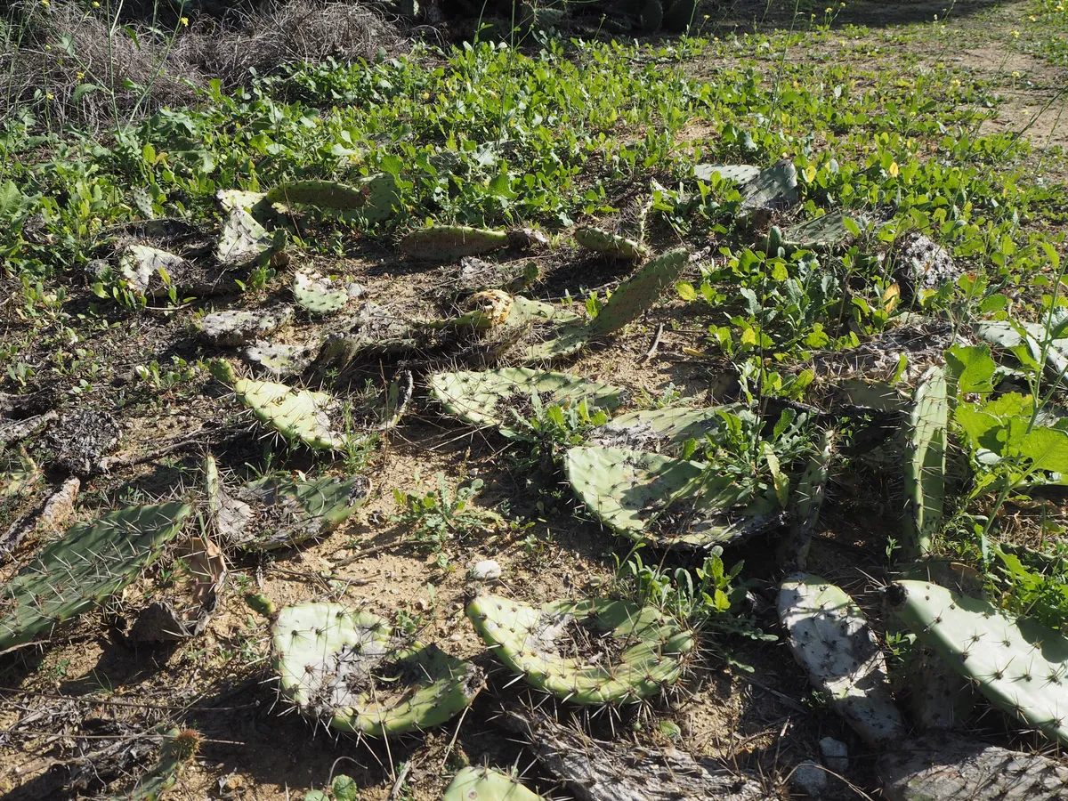
Anyway, the park is great. I saw a lot of interesting plants - as well as some active habitat restoration work. It was very cool to see these patches of cactus tacked down on the ground - this is one way to make more cactus! Neat!!
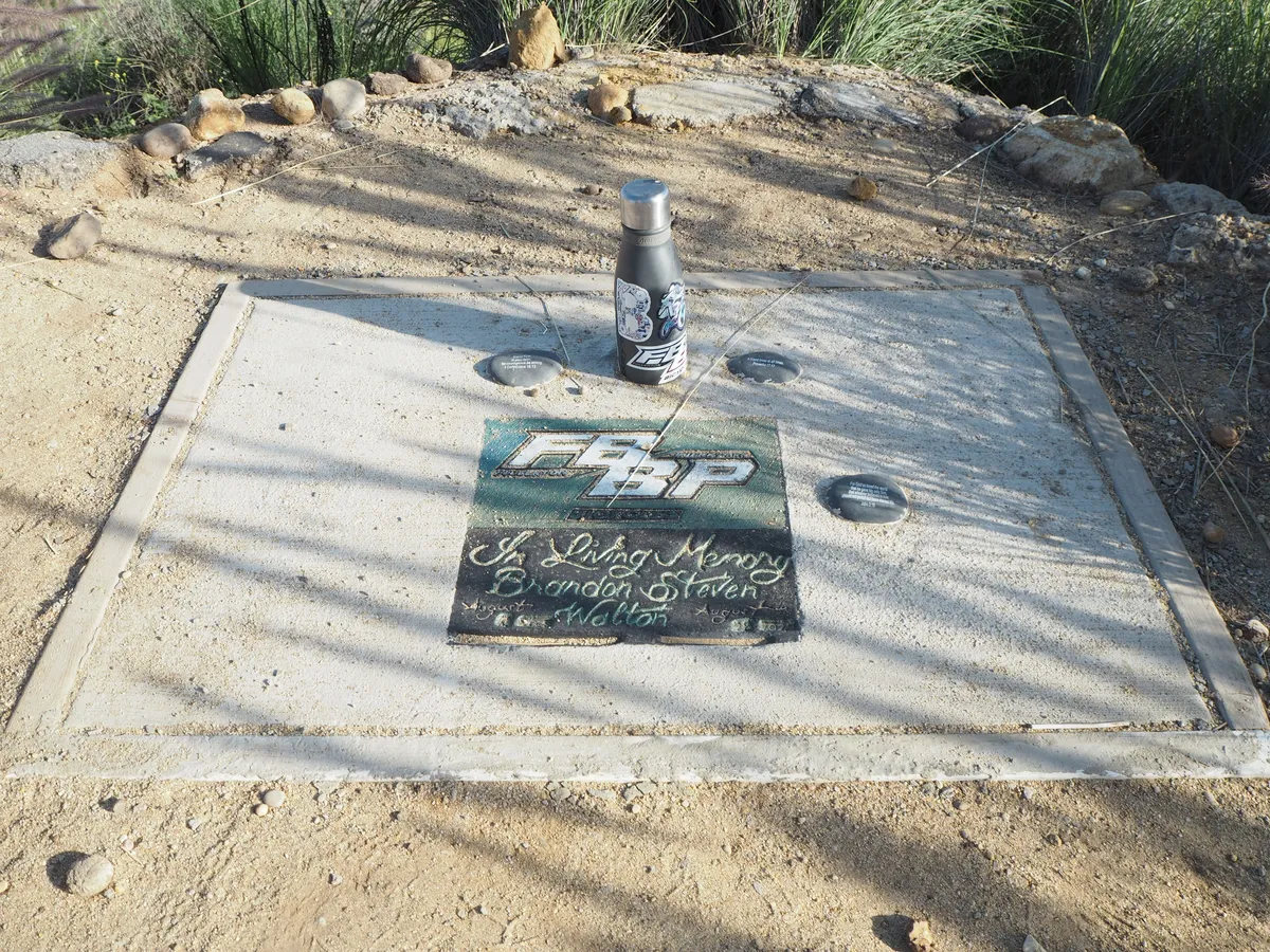
After doing a loop around the park, we decided we had enough energy to keep going, so we headed down to the Nora Kuttner trail I mentioned before. There's a hole in the fence leading to a particularly hilly area just outside the park which people are clearly using for mountain biking. We actually found a memorial here to a local mountain biker who had passed away. They cemented his water bottle down next to a plaque:
The Nora Kuttner trail spans almost the entire southern border of this land. Most of the time, it goes right around the immediate back of the neighboring housing developments. Bikes are permitted here, and we saw tons of them. We also saw a ton of dog walkers. There's an incredibly detailed description of the entire trail and the different ways you can access it on this website. I particularly appreciated this note:
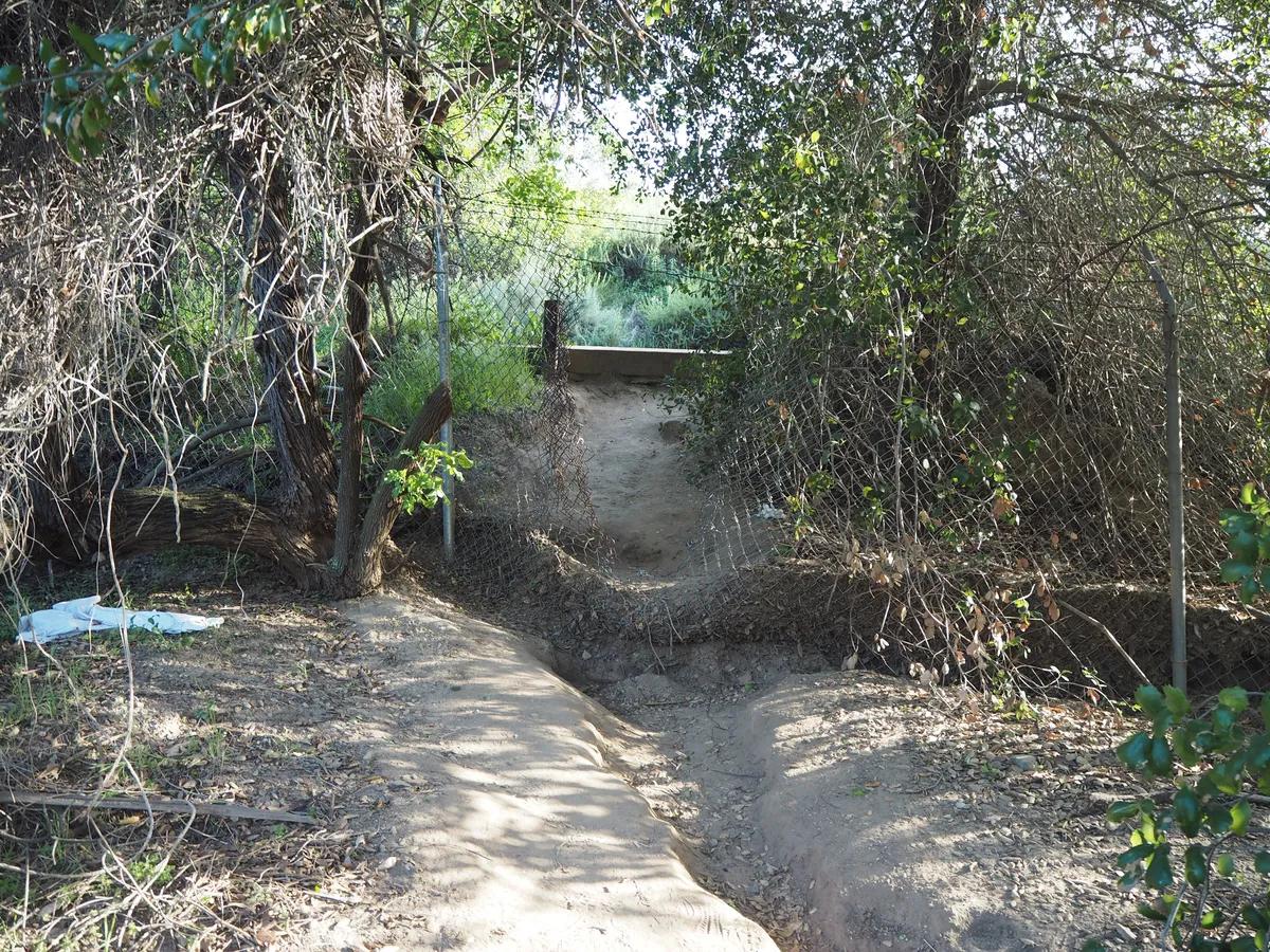
There is a place where people are constantly opening the fence and the oil company is constantly fixing it. The trail on the Chevron side is just as warn as the rest of Nora Kuttner. It is as if this is the only place people go. And there’s good reason. It is a view spot that is unimpeded by trees. No other spot in Fullerton offers that experience. If the Robert Ward Preserve is ever expanded, please go east to include this spot. . . 33 54 9.9069 -117 56 59.1375 alt-104
I don't think the website author and I are talking about the same spot, but we definitely found place in the fence that seems like it's constantly being opened. In fact, we saw someone ahead of us on the trail casually walk their dogs through this hole, duck under the barbed wire, and head into the Chevron land:
We just continued until we hit a major road. Our whole walk through the nature preserve and out to near the west end of the Nora Kuttner trail (we stopped at the baseball diamonds on Rosecrans) took us from about 1 PM to about 4:30 PM. We stopped very frequently, much more frequently than a normal hiker would, for me to take pictures of plants (or ants). Our whole trip was about 4.3 miles. Aside from the places we busted through fences, there wasn't any truly challenging terrain.
This is the trip that got me above 100 new 2026 species on iNaturalist. The vast majority of those were plants. Every time I go to one of these parks, I find a completely different mix of stuff - these hills are super fragmented and each has their own little thing going on. It's very, very cool. If the city does end up acquiring the rest of this land, I'll have to come back! The far west side of the hills have some dramatic bluffs you can see from Google Street View here.
Strong recommend from me!!